Day trip
Green Belt
The green landscape surrounding Bruges.
- Distance
- 53 km
- Time
- ≈ 3 h
- Ride type
- Day trip
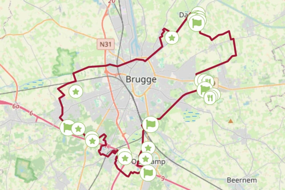
The green belt around Bruges: woods, fields and waterways in one relaxed day loop. Varied and quiet, away from the traffic.
Before you set off
- Ask us for a free map when you set off. We'll point you to the prettiest way.
- Wear a helmet and follow the signs and traffic rules.
- Check the weather before you set off and bring water.
- The map shows the way there from our shop (3.9 km); the whole route is 53 km. Ask us how to ride the rest.
- Drinking water on the way: km 1.1.
- Bike repair station on the way: km 1.8 and 3.5.
Along the way
What you pass between our shop and Green Belt, from OpenStreetMap.
Our shop
km 0.0
Drinking water
km 1.1
Chinese Keuken Lam
Restaurant · km 1.5
Kasteeltje Les Acacias
Castle or historic house · km 1.7
Bike repair station
km 1.8
Margaux
Café or bar · km 1.9
Sunkook
Restaurant · km 2.6
Floris
Restaurant · km 3.5
Bike repair station
km 3.5
Het Steentje
Castle or historic house · km 3.7
Green Belt
km 3.9
Opening hours vary, so check before you stop. Places: © OpenStreetMap contributors